|
Features Rich Mapping
Arvidion is an intuitive, scalable tool that allows your...
|
|
|
Features Rich Mapping
|
|
Arvidion is an intuitive, scalable tool that allows your organization to drive
efficiencies. Utilizing the latest technologies Arvidion provides you the ability
to create and sustain operational excellence. The Arvidion Solution integrates
the most powerful mapping system on the market. The fully integrated Bing mapping
system provides full feature rich mapping services that tech savvy users are accustomed
to using. Arvidion users can browse and search topographically shaded street maps
for many cities worldwide. Maps include built in points of interest such as metro
stations, stadiums, hospitals, and other facilities. It is also possible to browse
public user-created points of interest. Searches can cover public collections, businesses
or types of business, locations, or people. There are 5 primary types of street
map views available to Arvidion users: Road View, Aerial View, Bird’s Eye View,
StreetSide View, and 3D View.
|
|
Road view
|
|
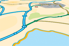
Road view is the default map view and displays a vector imagery of roads, buildings,
and geography.
|

|
|
|
|
Aerial view
|
|
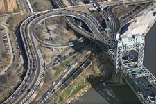
Aerial view overlays satellite imagery onto the map and highlights roads and major
geozones to be easily identifiable within the satellite images.
|

|
|
|
|
Bird's-eye view
|
|
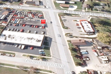
Bird's-eye view displays aerial imagery captured from low-flying aircraft. Unlike
a top-down aerial view captured by satellite, Bird's-eye images are taken at
an oblique 45-degree angle which gives the user better depth perception for buildings
and geography. Bird's-eye View is available in selected locations across the
globe[2], including major cities in the United States, Canada, Japan and in over
80 European locations. Bird's-Eye images may be viewed from all four cardinal
directions. These images typically have much more detail than the aerial views taken
from directly above. Signs, advertisements, pedestrians, and other objects are clearly
visible in many Bird's Eye views.
|

|
|
|
|
StreetSide view
|
|
StreetSide view provides immersive, panoramic (360 degree) imagery of street-level
scenes taken from special cameras mounted on moving vehicles. Launched in December
2009, it contains imagery for selected metro areas in the United States as well
as selected areas in Vancouver and Whistler British Columbia.
|

|
|
|
|
3D maps
|
|
The 3D map feature allows the user to see buildings in 3D, with the ability to rotate
and tilt the image in addition to panning and zooming. In an attempt to achieve
near-photorealism, all 3D buildings are textured using composites taken from aerial
photography.
|

|
|